


You should spend about 20 minutes on this task.
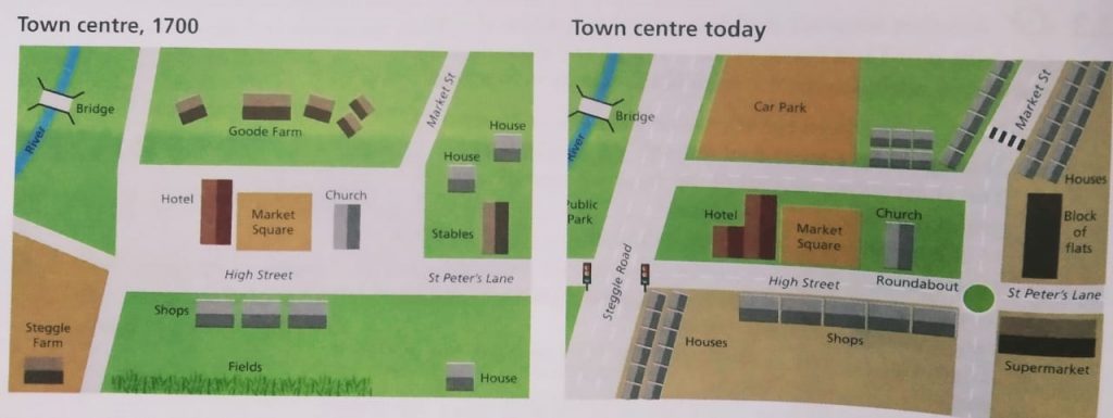
The following maps show the changes that have taken place in the centre of a town since 1700.
Summarize the information by selecting and reporting the main features, and make comparisons where relevant.
Write at least 150 words.
MODEL ANSWER:
The present day layout of a town centre when compared to 1700 is portrayed in the given maps.
It is clear from the maps that the market square is the centre of the town, with a church at its East, and this has not changed in 300 years. However, the hotel, which was located towards the West of the square, is seen expanded. The Steggle farm, which was at the Southwest of the square, is replaced with a three-lane road, which now crosses the High street and extends straight towards the North. Another farm, ‘the Goode farm’ which existed at the North of the square is divided into two halves for a housing colony and a car park.
The narrow market street is now expanded to a two-lane road, which intersects the High Street and the St. Peter’s lane, and extends further towards the South. The house and the stables, which were adjacent to the St. Peter’s lane are now reconstructed to a supermarket and a block of flats. Settlements are seen extended towards the Northeast of the flats. Houses are also added at the Southwest of the square. More shops are also added towards the South of the High street.
Overall, the town looks modernized now compared to the past.