


You should spend about 20 minutes on this task.
The maps below illustrates how Frenton changed from 1990 to 2012.
Summarize the information by selecting and reporting the main features and make comparisons where relevant.
Write at least 150 words.
MODEL ANSWER>>>
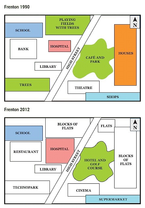
The transformation of a small town: Frenton, between 1990 and 2012 is portrayed in the given maps.
In 1990, Frenton was a small town, which was bisected into almost equal parts by the High Street. Towards the immediate East of the street, there was a café and a park and next to it, there were settlements (Houses). A theatre and some shops were there towards the South-east of the street. The four major establishments to the West of the street were a school, a bank, a hospital and a library. There was also a playing field with trees at the North of the town, adjacent to the street.
After 22 years, the Eastern part of the High Street changed a lot. Houses were developed to flats, which expanded towards the North. The Café and park got transformed to a hotel and a golf course. A supermarket replaced shops, whereas a cinema replaced the theatre. Settlements further expanded at the North, crossing the street, and the hospital increased its size. A restaurant occupied the space of the bank. Trees at the South were cleared for a technopark.
Overall, the development of the town in this short span of time was tremendous.