You should spend 20 minutes on this task.


You should spend 20 minutes on this task.
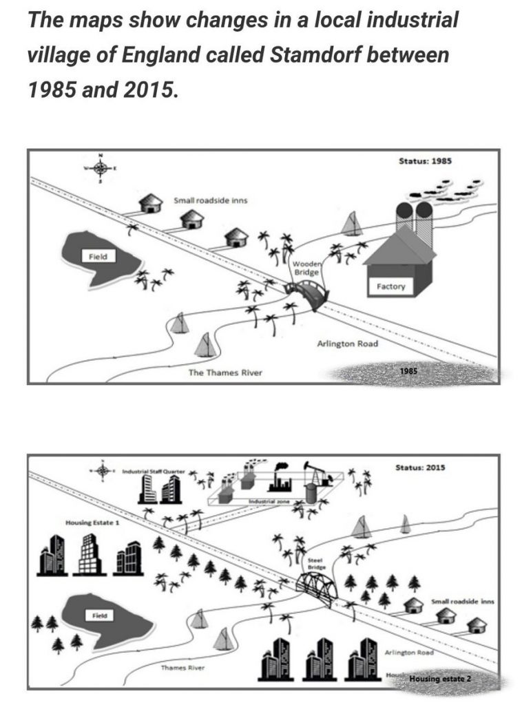
The transformations which occurred to Stamdorf, a local industrial village in England in 2015 when compared to its status in 1985 are portrayed in the given maps.
Overall, it is clear from the maps that the village had developed to a well-planned town over this period.
In 1985, the only notable establishment in the village was the factory on the banks of the river Thames, which was close to the wooden bridge in the Arlington road. Crossing the bridge, towards the northwest, there were small roadside inns on the right side of the road, and almost opposite to it, there existed a field.
In 2015, an industrial zone appeared exactly at the north of Stamford, with a staff quarters located to its immediate west. The road side inns were relocated to the other side of the river, near to the road, where the old factory was located. On the other side of the Arlington road, on both sides of the river, two housing estates emerged, the first at the north and the other at the south. The location of the field was changed further towards the river; the bridge was reconstructed with steel.
Word count: 189