


You should spend about 20 minutes on this task.
The two maps below show road access to a city hospital in 2007 and in 2010. Summarize the information by selecting and reporting the main features, and make comparisons where relevant.
Write at least 150 words.
MODEL ANSWER>>>
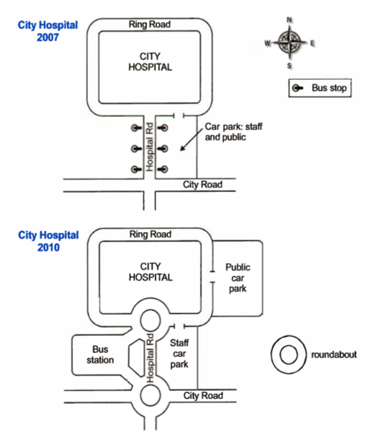
The upgradation of the road access to the city hospital in 2010 from how it was in 2007 is picturised in the given maps.
The three visible changes which can be observed are two roundabouts, a bus station and a separate car park for the public.
In 2007, the hospital, which was located inside the Ring Road Circle, had only one access to the City Road, and it was via the Hospital Road at the South. This straight road had six bus stops on either side and towards its East; there was a car park accessible for both the staff and the public.
The major developments in 2010 were the changes in public transportation system, which included the transformation all the six bus stops to a larger bus station towards the West of the Hospital Road and the construction of two roundabouts, one at the intersection of the road with the Ring Road and the other at the intersection with the City Road.
Finally, the provision of car parking towards the East of the Hospital Road was made exclusively for the staff and a new public car park facility was set up at the East end of the hospital.
Word count: 195