


You should spend about 20 minutes on this task.
MODEL ANSWER>>>
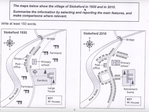
The transformation that took place in Stokeford village in 2010 compared to 1930 is depicted in the given maps.
As seen in the first map, in 1930, the village was connected by a central road, which crossed the River Stoke at the north. There existed some houses, shops, a post office and a primary school, which were proximal to the road. A large house, with gardens at the centre was a landmark, but the major portions of the village were farmlands.
By 2010, two roads in the northern part of the village, which ran perpendicular to the central road, provided connections to the new homes that replaced farmland on the east and to those that replaced shops on the west. The primary school underwent a considerable expansion with two parallel units extending towards the east.
More settlements came towards the central part of the village, particularly towards the south and the west. The large house got converted into a retirement home, with an addition of two wings and the surrounding garden got reduced almost by half.
Overall, it is clear that the village changed its outlook tremendously, and became more like a small town over the period.
Word count: 193