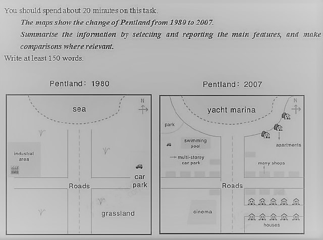
The way which Pentland, a coastal area was developed in 2007 when compared to 1980 is portrayed in the given maps.
Overall, it is clear that it has transformed to a small town between the years.
In 1980, the only major establishments in Pentland were industries, which were located towards the west. There were perpendicular roads, which divided the region to four parts. There existed a car park in the east of Pentland, opposite to the industrial area.
The major developments which Pentland witnessed were in the fields of entertainment and accommodation. At the southwest portion of the region, a cinema was constructed. Towards the north of it, crossing the horizontal road, a swimming pool and a park came into existence. To entertain those who enjoy pleasure trips in the sea, a yacht marina was made. Accommodation facilities included both individual houses at the southeast and apartments at the northeast of the coastal town. In between these settlements, shops were erected. The car park facility was also upgraded to a multi-storey one, located to the immediate south of the swimming pool.
Word count: 178


