You should spend about 20 minutes on this task.
The two maps below show road access to a city hospital in 2007 and in 2010. Summarize the information by selecting and reporting the main features, and make comparisons where relevant.
Write at least 150 words.
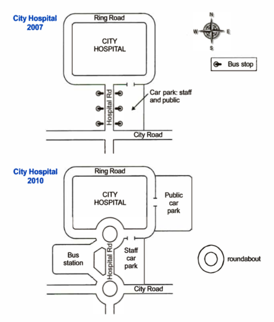
The way in which the road access to the city hospital transformed in 2010 when compared to how it was in 2007 is portrayed in the given maps.
Overall, the major changes which occurred are the construction of two roundabouts, a bus station and a separate car park for the public.
In 2007, the hospital, which was encircled by the Ring Road, was connected to the City Road via the Hospital Road at the south. This straight road had three bus stops on each side and towards its east; there was a car park accessible for both the staff and the public.
The major developments in the road access in 2010 were the construction of two roundabouts, one at the intersection of the Hospital Road with the Ring Road and the other at its intersection with the City Road. Traffic on the Hospital Road was eased by the construction of a bus station at the west of the road and by making the car park at the east exclusively for staff. A new public car park facility was set up at the east end of the hospital, adjacent to the Ring Road.
Word count: 188